If you could swap most car trips for flip‑flops or a cruiser bike, would you? In Neptune Beach, that picture comes into focus fast because daily essentials cluster close to the sand and the town’s core streets. If you're relocating and want a clear view of what coastal living actually looks like here, this guide walks you through walk times, bike routes, beach access, seasonality, and practical buyer checks. Let’s dive in.
Why Neptune Beach feels walkable
Neptune Beach is a compact, coastal town bordered by Atlantic Beach and Jacksonville Beach. Neighborhood streets near the ocean sit within short walking distance of commercial corridors and public beach access points, which creates a naturally pedestrian‑friendly core. Many daily needs, like coffee, casual dining, and small services, cluster around town center streets that run close to the shoreline. For larger supermarkets and some professional services, you will likely make a short drive or bike ride into neighboring beach cities or the mainland.
Know your 5, 10, 15‑minute circles
Before you tour homes, picture your day in time slices rather than miles. A helpful rule of thumb:
- 5 minutes is roughly 0.25 mile.
- 10 minutes is roughly 0.5 mile.
- 15 minutes is roughly 0.75 to 1 mile.
Center those circles on a property you are considering and ask what fits inside each. Coffee, a breakfast spot, the nearest public beach access, and an evening patio within a 10‑minute walk can transform your routine. Use Google Maps walking mode to time actual door‑to‑door routes, and review neighborhood‑level ratings on Walk Score for a second opinion on walkability and bikeability.
Paths, beach access, and daily routes
Sidewalks and crosswalks are typically densest near Neptune Beach’s commercial corridors and the residential blocks closest to the ocean. As you move inland and onto side streets, sidewalks can be intermittent, so it is worth checking your daily route on foot or in Street View. Neptune Beach maintains multiple public beach access points that link neighborhood streets to the shoreline, which matter for morning walks, sunset strolls, and surf checks. To confirm exact locations and any access numbering, use the Town of Neptune Beach official site or contact the planning or public works department.
When testing a prospective home, time a morning routine on foot: door to coffee, then the nearest beach access, then back home. Note where sidewalks narrow, where crosswalks concentrate, and where you might prefer a bike.
Biking Neptune Beach
Biking is realistic for trips up to about 2 to 3 miles, especially with an e‑bike that flattens coastal breezes. Expect a mix of on‑street bike lanes, low‑traffic residential streets, and the primary north‑south coastal road, State Road A1A, as your backbone. For statewide bike and pedestrian context, including projects that may affect A1A, check the Florida Department of Transportation.
Map your safest routes between your home, town center, the beach, and nearby grocery options. Look for signed lanes, lower speed limits, and wide shoulders. Also confirm short‑term bike parking at your most‑used destinations.
Transit, rides, and parking
Public transit can supplement low‑car living but probably will not replace a car for every errand. The Jacksonville Transportation Authority operates regional bus routes that serve the Beaches. Review current maps and service levels on the JTA website and note that schedules may change seasonally.
Parking in Neptune Beach typically includes a mix of short‑term street parking and small municipal lots near the beach and town center. Expect higher demand during summer and holiday weekends. For locations, time limits, and any paid zones, confirm with the Town of Neptune Beach.
Where daily life clusters
Local life concentrates in a few practical clusters. Use these as a lens when comparing addresses.
Morning stops within a stroll
- Coffee shops, bakeries, and breakfast diners tend to sit near the oceanfront or central streets.
- Public beach access points are often just a few minutes from residential blocks near the water.
- If you like sunrise runs or dog walks, verify any beach rules and preferred routes close to your home base.
Errands and essentials
- Convenience markets and small services are commonly within a 5 to 10‑minute walk in the town core.
- Full‑service grocery stores and pharmacies are often just outside Neptune Beach’s municipal border, which may require a short bike or car trip.
- Delivery apps can fill gaps, especially for larger shops you do not want to carry by hand.
Midday and leisure
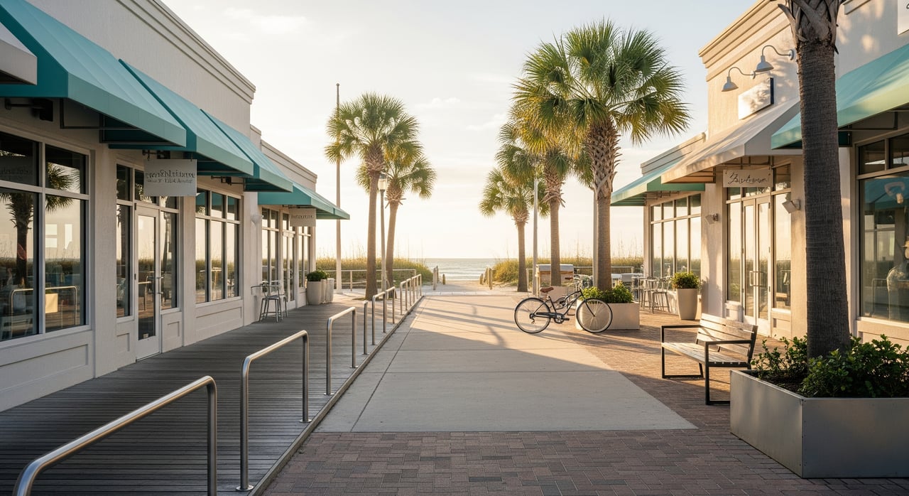
- Casual lunch spots, patios, boutiques, and surf or bike shops cluster close to the beach or town center.
- Weekdays in the off‑season are quieter, while warm months bring steady foot traffic near outdoor seating.
Evenings and dining
- Seafood restaurants, bars, and live‑music venues are concentrated near the oceanfront. This is convenient for dinner by foot, and it can also mean higher weekend noise if you live a few doors away.
Services for daily life
- Dental and medical offices, vets, salons, banks, and schools are spread across Neptune Beach and neighboring cities.
- If you plan a low‑car lifestyle, map the closest options for your routine and weigh the practicality of walking or biking to appointments.
Seasonality and daily rhythms
Summer and holiday weekends bring larger visitor volumes, which means more pedestrians, busier restaurants, and tighter parking near the beach. This can be a perk if you love lively streets, or a tradeoff if you prefer quieter blocks. Off‑season days in fall and winter deliver the clearest snapshot of full‑time resident life.
Beach operations also shape daily decisions. Lifeguard hours and flagged swim warnings typically expand during peak seasons, and surf conditions can change your plan on a given day. For daily conditions and tides, check NOAA’s tides and currents. Dog access rules, parking enforcement, and vacation‑rental ordinances can affect neighborhood character as well, so review current regulations on the Town of Neptune Beach site.
Buyer checklist: verify walkability
Bring this list on your next scouting trip or virtual tour.
- Time the walk from the property to the nearest public beach access, your preferred coffee spot, and casual dining. Record one‑way minutes.
- Note sidewalk continuity, crosswalks, and lighting along routes you will use daily. Take photos or check Street View.
- Map your safest bike routes to town center, the beach, and grocery. Look for signed lanes, wide shoulders, and lower‑speed streets.
- Confirm short‑term bike parking at places you will visit often.
- Check JTA bus stops and frequency on the JTA website. Verify ride‑share availability early morning and late night.
- Observe on‑street parking near the property at different times, including weekends and holidays. Ask about guest parking rules.
- Listen for weekend noise near restaurants and venues. Visit during peak season and off‑season if possible.
Coastal‑living logistics and costs
Coastal convenience comes with a few paperwork and insurance realities. Before you make an offer, review:
- Flood zone designation and whether flood insurance is required. Use the FEMA Flood Map Service Center to find the property’s panel and confirm elevation details.
- Utilities, HOA guidelines, and local ordinances. Rules about parking, bike storage, and short‑term rentals can affect your daily rhythm.
- Insurance considerations for wind and hurricane coverage. Ask about mitigation features such as storm shutters or elevated construction.
Plan your scouting trip
Turn your research into a lived experience. Here is a simple on‑the‑ground plan that works for an afternoon tour.
- Start with a coffee and a 10‑minute neighborhood walk. Note sidewalks, shade, and crosswalks.
- Walk to the nearest public beach access and time the return trip. Imagine doing this before work or after dinner.
- Bike a short errands loop: town center to a nearby market or pharmacy, then home. Choose the calmest streets and mark any tricky crossings.
- Visit again at dinner hour. Walk to a casual spot and back. Pay attention to evening activity, lighting, and noise.
- Check tomorrow’s tide and conditions with NOAA and repeat in the morning to see the weekday rhythm.
If you like to plan with maps, layer your 5, 10, and 15‑minute walking circles over a list of must‑have amenities. Add a simple bike‑route overlay that favors low‑traffic streets and A1A only where necessary. For context on state road improvements, keep an eye on FDOT updates, and use Walk Score to compare neighborhoods quickly.
Ready to explore homes?
Your version of walkable coastal life is personal. Some buyers want a quiet street two blocks off the beach, others want to live steps from dinner and music. If you would like a curated property list and a custom walk‑bike map that matches your daily rhythm, reach out to Meredith Rowe. She will help you compare addresses by actual minutes, not miles, and guide you through the coastal details that matter.
FAQs
Is Neptune Beach walkable for daily errands?
- Many daily needs cluster near the oceanfront and town center, so errands can be walkable from central neighborhoods, while larger supermarket trips may require a short bike or car ride.
Where can I find Neptune Beach public beach access information?
- Use the Town of Neptune Beach official site to confirm exact public beach access points and any numbering or rules.
Does Neptune Beach have public transit I can rely on?
- Regional bus routes serve the Beaches through the Jacksonville Transportation Authority, and you can confirm current maps and frequency on the JTA website.
Is biking practical year‑round in Neptune Beach?
- Yes for many trips under 2 to 3 miles, and e‑bikes extend your range, though you should plan around heat, storms, and seasonal traffic using context from FDOT.
How busy is Neptune Beach in summer, and why does it matter?
- Summer and holiday weekends bring heavier visitor traffic, which increases pedestrian activity, restaurant waits, and parking demand near the beach and town center.
What flood zone and insurance steps should I take before buying?
- Check the property’s flood zone on the FEMA Flood Map Service Center and discuss wind and flood insurance requirements and mitigation features with your advisor.